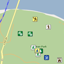
Use this neighbourhood interactive map to find swimming pools, sports fields, parks, playgrounds, golf courses and spray parks that are in your neighbourhood. Locate fire stations, police stations and bus stops anywhere in the city.
Find the City amenities - swimming pools, sports fields, parks, playgrounds, golf courses and spray parks - that are in your neighbourhood.
Locate fire stations, police stations and bus stops anywhere in the city.
You can mark your current location or home address with a red pin and search for City amenities within a 0.5km to 10km range.
Type in your address, click on the red pin and get your property assessment and waste collection schedule.
The Interactive Neighbourhood Map is an online mapping tool utilizing the most current road and facility mapping coordinates within the City's database.
For more information on how to use the map, check out the Neighbourhood Interactive Map page.
If there is something you can't find or have feedback about the new map please let us know by filling out our Report a Bug form.
| Online |
Interactive Neighbourhood Maps |
| MapFeedback@edmonton.ca |